|
| N° | Surname and name | Profession |
| 1 | Alassane Sané | English teacher |
| 2 | Sow Mohamedou | French teacher |
| 3 | Abderrahmane Djibril | Teacher of English and French |
| 4 | Baba Ahmed O/ Isselmou | |
| 5 | Leman O/ Lahmeid | |
| 6 | Dah O/ Vally | |
| 7 | Sidi Med O/ Hamoud | |
| 8 | Ne O/ Sid’Ahmed Vall | Imam Mosquée Commune Techinatt, locale Iguenibak |
| 9 | Cheikhnena O/ Lemana | |
| 10 | Med Lemine O/ Sid’Ahmed | |
| 11 | Zeinabou M/ Minnih | |
| 12 | Sektou M/ Sidi Mohamed |
Stage: Municipality of KIFFA
Generalities / Administration
- Area: 36.600 km²
- Regional Capital: Kiffa
- Population: 284629 inhabitants
- Male: 133826
- Female: 150803
- Number of Moughataas: 5 (Guérou, Kankoussa, Barkéol, Boumdeid, Kiffa)
- Number of municipalities: 26
- Average home size: 5,7
The vilayet of Assaba has an area of 36 600 km². It borders in the north with Tagant and Brakna, in the south with Guidimakha and Mali, in the southwest with Gorgol and in the east with Hodh El Chargui.
The Vilayet of Assaba
The population was estimated at 284.629 inhabitants in 2007. Kiffa is the regional capital.
It is made up by six municipalities, one of which - the municipality of Kiffa – has a population of 32716 inhabitants.
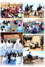
The Citizens’ Assemblies which were organized in several neighborhoods in Kiffa and which gather different citizen categories (women, young people, teachers, farmers, cattle raisers, shopkeepers) have allowed the participants to pose several problems and to discuss them.
The population of Kiffa lives in extreme poverty and lacks drinking water. There are also environmental and public health problems, problems connected with access to new information techniques and Citizenship and Democracy problems.
Young people face an absence of cultural and recreational animation. One recurrent issue during the debates was the role of young people in Citizens’ Assemblies.
The bankruptcy of the educational system and the absence of job prospects push young people to demand the Education General States. The absence of electricity and administrative structure in several neighborhoods of the city and the high rate of pollution constitute some of the main worries that these populations have.
The people found there expressed a desire to develop an citizens’ agreement framework.
Human Resources / KIFFA
| N° | Surname and name | Profession |
| 1 | Med Mahmoud Sidaty | History and Geography teacher |
| 2 | Bahi O/ Sleymane | Secondary school teacher |
| 3 | Adama Yaya Diop | Secondary school teacher |
| 4 | Sow Cheikh Med Vadel | Teacher |
| 5 | Seyid Samba N’Diaye | Teacher |
| 6 | El Mechri O/ Med Lemine | Teacher |
| 7 | Sabah O/ Cheikh Mahfoud | Student |
| 8 | Med Mahmoud O/ Med | Student |
| 9 | Med Abdellahi | Student |
| 10 | Cheikh O Ahmed Salem | |
| 11 | Abderahmane O/ Moustaphe | Teacher |
| 12 | Baguily Mohamed O/ | Teacher |
| 13 | Abdel Baghy N’Diaye | |
| 14 | Ahmed Tahar O/ Abdellahi | English teacher |
| 15 | Youssouf Thiery Sylla | Forestry Engineer |
| 16 | Thiam Mamadou Alassane | Regional youth delegate |
Stage: Municipality of ALEG
Generalities / Administration
- Area: 33.000 km²
- Regional Capital: Aleg
- Population: 282168 inhabitants
- Male: 131463
- Female: 150705
- Number of Moughataas: 5 (Bababé, Boghé, Magta-Lahjar, M’Bagne, Aleg)
- Number of municipalities: 21
- Average home size (2000): 6,7
The vilayet of Brakna is located in the southernmost area of Mauritania. It covers an area of 33000 km² and borders in the east with Assaba, in the southeast with Gorgol, in the south with the Senegal river, in the west and the north with TRARZA and in the northeast with Tagant. The weather in Brakna is Sahel in the southeast and sub-Saharan in the north and west.
Apart from the Senegal river, the Region has several lakes, ponds and temporary uadis which play a socio-economic role in the towns: Lake Maal, Lake Aleg, Pond Cheggar, Pond Gadel and Uadi Ketchi.
The topography is quite flat but large expanses of fixed sand dunes and prairie vegetation can also be found.
The population was estimated at 282.168 inhabitants in 2007. The Capital of the Brakna and Moughataa regions is Aleg. Aleg is a municipality inhabited by twelve thousand eight hundred and ninety-eight people (12.898).
The Vilayet of Brakna
The city of Aleg is facing a shortage of water. The sedentarization of ancient nomads running away from droughts occurred together with urban development, and caused a lack of water distribution and storage equipment as well.
In Aleg several rooms are built on spillage axes and in flood zones. Mauritanian tents and brick houses coexist in this city.
There is also no urban transport. The participants in the Citizens’ Assemblies, which gathered mainly women, young people, teachers, cattle raisers, farmers and shopkeepers, insistently pointed out some marked deficiencies in school structures and female school drop-out rates.
Electricity coverage is still insufficient and the rural sector does not have access to agricultural loans. Agricultural financing is unsatisfactory. Territorial disputes and shepherding problems are quite common. Divorce rates are very high and women still bear the main responsibilities in marriages.
Unemployment is chronic and affects all social strata.
Human Resources / ALEG
| N° | Surname and name | Profession |
| 1 | Oum Khoursoum Mint Haïbetty |
Stage: Municipality of KAEDI
Generalities / Administration
- Area: 13.600 km²
- Regional Capital: Kaédi
- Population: 281 503 inhabitants
- Male: 134 258
- Female: 147 247
- Number of Moughataas: 4 (M’Bout, Maghama, Mounguel, Kaédi)
- Number of municipalities: 29
- Average home size (2000): 7,0
The vilayet of Gorgol is located in the southernmost area of Mauritania. It covers an area of 13600 km², and borders in the north and northeast with Assaba, in the south and southeast with Guidimaka, in the northwest with Brakna and in the southwest with the Senegal river.
The Vilayet of Gorgol
The relief is dominated by a network of valleys and by the presence of a system of hills and plateaus. The hydrographic network is made up by the Senegal river and its tributaries: The White Gorgol, the Black Gorgol and the uadi Ghorfa. In 2007, the vilayet had a population of 281.503 inhabitants. Kaédi, the capital of the Gorgol region and of Moughataa, is the most important municipality of the vilayet of Gorgol. Inhabited by thirty-four thousand two hundred and twenty seven people (34.227), it is the seat of several delegations of the main State utilities. Kaédi is divided in three zones: old quarters (Touldé, Gourel Sanghé and Tantaaji), new quarters (Modernes and Jedida) and the periphery (Khilinkaare, Tinzah, Sinthiane and Kebbe). The vilayet has insufficient road infrastructure: it only has one asphalted axis which links Kaédi with Boghé; the rest of the road network is made up by trails, the majority of which are impassable during rainy season. The population is extremely poor. The majority are living under the extreme poverty line.
Agriculture is the main activity of the population (78,6% of the homes) but they cannot support themselves with it. The agricultural facilities are rudimentary and do not allow the population to obtain any profitable yielding. The Kaédi population lacks organization and education. There are no policies to support the country’s cooperatives’ development. The unemployment rate for young people is the highest in the country (13%) and the literacy rate is one of the lowest (36%). Young people face education, prospects and career opportunity problems. Electric coverage is not well distributed. Kaédi is marked by a marked worsening of malaria, which results in insufficient personnel, infrastructure and sanitary equipment. The city shows problems in waste management, the consequence of which is felt by the population.
Kaédi has a National Agricultural Research Center, a National Agricultural Popularization School and several agricultural projects. The Senegal river and its tributaries offer many opportunities for agricultural, cattle raising and commerce development.
Human Resources / KAEDI
| N° | Surname and name | Profession |
| 1 | Yacine Koné | Midwife / Hospital |
 Top
Top

